
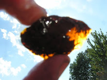
Bull frog, Mulberry Meadow Brook, Foundry Street, Furnace Village, South Easton, Massachusetts. July 7, 1996.
The geological story of South Easton is much more mysterious than North Easton's. What we do know is South Easton has been flat and swampy for a lot of the last 300 million years. How do we know this?
The bedrock geology map of Massachusetts shows the bedrock of Easton changes dramatically along a west to east line roughly drawn from Rockland Street to Allen Road to Lincoln Street to Main Street to Torrey Street. North of this line is nothing but Dedham granodiorite, a hard, fine-grained granite that is 620 million years old. This is the "basement" that underlies all of Easton and much of eastern Massachusetts.
South of Main Street, the Dedham granite dives deep underground and is covered by a 250 million year old set of folded sedimentary rocks called the Rhode Island Formation which covers much of southeastern Massachusetts and Rhode Island. These rocks tell us that 300 million years ago, South Easton was at the edge of a vast coal forest and swamp stretching from South Easton to Cape Cod and from Plymouth to Providence. How do we know this? Not from South Easton.
As anyone in Easton knows, exposures of bedrock south of Main Street are rare to non-existent. Even tiny hills are uncommon and the only boulders on the surface were dragged and dropped by the last glaciation and came from the north. The last glaciation covered South Easton with a thick coat of sand, gravel and a jumbled mix-up of sand, rocks and boulders called till, leaving the bedrock buried a dozen to a hundred feet underground. The lowest spots were flooded, allowing peat swamps to develop, like the Hockomock and Little Cedar Swamp, with peat depths of 20-40 feet and remain wet today. South Easton for a bedrock geologist is like the Sahara for a rainforest botanist. Na ga happa.
But bedrock geologists are strange folk. Throw a great mystery at them, with virtually no evidence, and they will scurry and nose about like Queequeg T. Dog, Ph.D. looking for the last molecule of food on the dinner plate, or looking for a good tenting spot in the Hockomock Swamp:
Note in the Queequeg T. Dog, Ph.D. video of the Hockomock that from what we know of Appalachian coal forests, they looked quite similar to the Hockomock today, and some plants in Easton, like royal ferns, have changed very little in the past 300 million years.
The Mystery of the Narragansett Basin
We know that a broad swath of southeastern Massachusetts, with its northern end at Easton below Main Street, is a very old freshwater basin, the Narragansett Basin, that over millions of years was filled with stream-washed sand, silt and rounded stream cobbles. Geologists are quite sure this basin first developed about 300 million years ago and rapidly began to fill with sediment from uplands to the north and northeast, creating a broad, flat and very wet plain of swamp and forest.
We know this because plant fossils from the bedrock which hardened from these sediments date to the Pennsylvanian Period (315-290 million years ago) and are typical of a vast forested, freshwater wetland. These fossils have never been found in South Easton, but have been found in bedrock exposures in Brockton and other nearby towns. The tree and plant species identified are typical of an Appalachian coal swamp. We know these were coal forests because small deposits of coal are fairly common in various spots around southeastern Massachusetts and Rhode Island. Many of these lenses of coal were first discovered by homeowners digging wells in the 1900s. Despite a great hoo haa by local captains of industry, these beds of anthracite coal proved immune to mining because they are small, thin, buried deep under glacial debris and contain 20 percent or more ash after burning.
We also know that the coal forests of the Narragansett Basin created petrified wood, which was found in place in by Clifford A. Kaye in the 1960s in Plympton and as wave-polished glacial drift on the beaches of Martha's Vineyard and the south Cape.
These plant fossils, coal deposits and petrified wood give us a fairly good picture of what South Easton looked like 300 million years ago. It was like the northern edge of a giant Hockomock Swamp surrounded by slightly higher ground and streams flowing into it -- not radically different than what we see today, but with different tree species.
What we don't know is what made the Narragansett Basin a basin in the first place. We know when it sank, but what made it sink?
To get at this conundrum we have to recall that all of Easton and eastern Massachusetts is a chunk of West Africa which split off and set sail for North America around 600 million years ago. This chunk of West Africa (called "Avalonia") slowly smacked into North America from north to south from 375-325 million years ago, first hitting Newfoundland, then maritime Canada, then coastal Maine and then Massachusetts. If you drill down deep enough anywhere in Easton you will hit this Dedham granodiorite. In North Easton it is right on the surface. South of Main Street it is dozens or hundreds of feet below the surface.
After Easton was done smacking into North America, about 320 million years ago the granite bedrock of southeastern Massachusetts began to stretch and thin, causing the crust to sink, creating the Narragansett Basin. While the mechanism and details of this stretching period are poorly understood, we do know what happened soon after: the basin quickly began to fill. We know this basin was landlocked, since it contains no marine fossils and only freshwater fossils, but its depth is still not known. And because the basin was freshwater and filled with trees, we know it must have existed within a fairly large chunk of continent, or else saltwater would have come pouring in from the sides.
The Hockomock: a modern coal swamp?
Coal beds are formed when forest trees die and are quickly submerged underwater, which keeps them from rotting. To make coal you need lots of trees growing for a long time in a very wet environment, with each tree growing on top of the trunks of those which have died and the dead trunks staying underwater. What you need to make coal is a ginormous forested swamp.
South Easton's Hockomock Swamp might be thought of as a modern coal forest. In 1970, several square-ended dug-out canoes were found in the Hockomock in West Bridgewater by muskrat trappers. The canoes are more than 500 years old, and most likely are much older than that. This shows how water can perfectly preserve wood for centuries.
Research shows that the Atlantic white cedar, or at least its genus, Chamaecyparis, have been around for at least 60 million years. Atlantic white cedar are the King Tree of the Hockomock and its oldest and longest living resident, next to box turtles, of course. It is possible that the Hockomock has been a cedar swamp for the past 50 million years, interrupted by glaciers, and coming back again when the glaciers melt.


A honkin' Atlantic white cedar in the Hockomock.
The trees in the Hock are growing on top of a layer of peat and tree trunks that is 40 feet or more thick. Peat is a precursor of coal. And coal is made from very deep layers of peat and tree trunks that have been shoved deep enough into the Earth's crust so that the heat drives out the water and compacts and bakes the peat and tree trunks until they are almost pure carbon.
The lack of thick coal beds in southeastern Mass. suggests that the Narragansett Basin was wet enough and stable enough to form lush wetland forests, but these forests were frequently interrupted and buried by incoming floods of sand and sediment from the surrounding uplands and had to start all over. It's not known how much of South Easton's coal beds were eroded as rock after they were folded and crumpled, and how much were scraped away by the numerous glaciers which advanced across Easton like one-mile thick bulldozers during the past 1 million years. It's at least possible that Easton once had coal beds as thick as those in Pennsylvania, but most of it was plowed onto the continental shelf past Nantucket, where it still resides in little tiny pieces.
 My brother Tim's dog, Queequeg T. Dog, Ph.D., takes a swim in Black Brook in the Hockomock, July 18, 2009. Queequeg wants to go tent camping there this summer for a week.
The Pondville Conglomerate
This past July, my wife Lori and I took a walk into Borderland to illegally swim in Puds Pond. We illegally parked at the head of "Bob's Trail," which begins at the corner of Allen Road and Bay Road.[1] After awhile we entered an area that had been a cow pasture or hayfield in the early 20th century. And there we encountered a very big rock, about 7 feet across, just sitting on the ground. But this was a goofy rock. It looked nothing like the granite boulders you see all over North Easton. This was made of tennis ball-sized, polished white and grey stones in a matrix of coarse sandstone, like plums in a pudding. We had found an errant piece of the Pondville Conglomerate.
 Glacial erratic of Pondville Conglomerate, just west of Bay Road in Borderland.
After the 620 million year-old Dedham granodiorite, the oldest exposed bedrock in Easton is called the Pondville Conglomerate, named after the Pondville railroad station in Norfolk, Mass., where it was first mapped and studied. A small lens of Pondville Conglomerate is mapped on the grounds of Stonehill College, behind Moreau Hall.
Conglomerate looks like very coarse gravel which turned into solid rock. The Pondville conglomerate began to form about 315 million years ago, when the Narragansett Basin sank and streams from the uplands to the northeast washed billions of fist and golf-ball sized water-worn cobbles into the depression. Later, as the basin filled and flattened, and the uplands were worn down, the basin filled with finer sand and silt until the basin was flat and wet enough to support a vast coal forest. In geologic terms, this forest did not last for long, maybe about 15 million years. And then South Easton was smacked again, this time at a distance.
What's odd about the piece of Pondville Conglomerate we found in Borderland is that it shouldn't be there. The only exposure of Pondville Conglomerate in Easton is on the grounds of Stonehill College, three miles to the east. This boulder was obviously a glacial erratic and must have been carried in the ice from somewhere north of Borderland. A glance at the Massachusetts bedrock geology map shows an exposure of the Pondville Conglomerate in Canton and Norwood, in almost a direct north-south line to Borderland. This must have been where the last glacier plucked out this boulder from the bedrock and dropped it 20 miles to the south in the woods along Bay Road. Cool.
 One of the stones in the 300 million year-old Pondville Conglomerate.
Africa's Second Date with Easton
Geologists are very certain that about 290 million years ago, the full brunt of Africa smacked into North America, creating what is called the Alleghanian Orogeny. This impact created the middle and southern section of the Appalachian Mountains.
The full impact was well south of Easton, and more towards the mid-Atlantic states. But the effects in Massachusetts were still severe. Thousands of feet of loose sediment in the Narragansett Basin were crumpled and folded and baked as they were driven down towards the Earth's mantle, including the trunks of millions of coal forest trees, creating the thin, folded beds of coal that dot southeastern Mass. and Rhode Island today.[2]
When sedimentary rock is pushed toward the mantle it heats up and is subjected to enormous pressure, causing the sediment to harden and recombine chemically into new new minerals, ie. metamorphism. Each metamorphic mineral forms at a different temperature and pressure regime. Because of this, metamorphic minerals are used as thermometer and a barometer to tell how deep and how long a slab of sediment was pushed to great depth. The metamorphic minerals found in the coal forest sediments of Easton show they were subjected to fairly low levels of metamorphism when they were crumpled and folded. [3]
The metamorphic history of the bedrock of southeastern Mass. is very complicated, which means, once again, there are far more mysteries than knowns for the period after African smacked into North America and created Easton around 350 million years ago and then smacked into it again 290 million years ago. The lack of bedrock exposures in South Easton makes untangling this history much harder, since graduate students and collegiate geologists rely on easily accessible exposures of bedrock to do their work. What would be useful to have are well drilling cores from Easton that go deep into the underlying bedrock. If Wayne Southworth is reading this, please give a shout.
South Easton, after Africa
What we do know is that after about 250 million years ago, the sediment and trunks of the coal forests of South Easton, now crumbled and folded into solid rock buried deep beneath the surface, cooled to "closure" temperatures for metamorphic minerals. Aside from erosion, not much has happened to these rocks since. So what's happened in South Easton since 250 million years ago? We don't know and will never know. But the Easton Country Store had Bisquick that old.
Thanks to our friends erosion and the glaciers, every bit of rock and every bit of history in South Easton after 250 million years ago has long ago been ground into dust and washed into the Atlantic Ocean. Every dinosaur track, every dinosaur bone, every vestige of every living and non-living thing that has resided in South Easton from 250 million years ago until the end of the last Ice Age 15,000 years ago is completely gone. We have no clue nor will we ever. But South Easton is still here. And still swampy.
Cheap, Gratuitous South Easton Joke for Mark Murphy:
Why did God make South Easton so flat?
So when they passed out in the front yard, they wouldn't roll off.
NEXT: The Rattlesnake Hill Pluton, the weird volcanic rocks at Oakes Ames Hall, and more cheap jokes about South Easton.
[1] I fully support the Uber-Draconian Rulez at Borderland because it keeps out the idiots with ATVs and SUVs who would quickly turn the place into the Sky View Drive-In at 7 a.m. on Sunday morning in terms of total McDonald's, Burger King and Wendy's trash, forest fires, rutted roads, broken Zima bottles, human feces, toilet paper hanging like confetti from high bush blueberry, and poorly hacked off live trees ostensibly to be used as "firewood" until the cops come. Being a duplicitous hack, I reserve the right to break these Rulez as they pertain to taking a swim in Puds Pond, which is the clearest, cleanest and bestest swimming pond in the Entire World. According to the Rulez, if you wear a fake dog suit, you can swim in Puds Pond all day long.
[2] The thinness and intermittency of the coal seams in southeastern Mass. and Rhode Island suggests the Narragansett Basin was only sporadically conducive to coal forest growth and massive trunk burial (which creates coal), and nothing like the thousands- feet thick coal beds of Pennsylvania and West Virginia. But sporadically, in the terms of a coal forest, could still be a million years. Geologic time is weird that way.
[3] A unique clue to the grade of metamorphism in Easton can be seen behind Sedell's Pharmacy and Tedeschi's variety along Main Street in North Easton, next to the North Easton Post Office. The volcanic bedrock exposed there, which was skun-up by bulldozers at the time, contain fractures lined with very small, gem-clear crystals of emerald green epidote. I took samples of these in 1997 and put them in a box somewhere. When I find them, I'll take pix and post them. They are quite pretty.
NOTE: Because nearly all geological research and review papers are inaccessible on-line due to a paywall which charges $20 or more per paper, even for papers published 50 years ago, the summary above is based on abstracts of many research papers and is far less informative than I would prefer to present. This paywall system basically prevents anyone except professional geologists from learning anything about the natural history of their own town or region. I'm not sure keeping people dumb is a good way to increase scientific literacy.


3 comments:
Doug- Loved your articles on Easton geology. I grew up in South Easton and used to occasionally find chunks of coal. I always assumed they were tossed off pieces from heating some home. Fascinating to learn they are part of the natural geology.
Your explanation of the complicated geology of the region is fascinating, immensely readable and clearly explained for the non-technical. Great stuff! Thanks! -Allison
Great writing - I really the story you are telling.
I'm sitting at my desk (in Norfolk, Ma.) looking at a chunk of Pondville Conglomerate on my desk that I plucked off the side of a road in Attleboro. It's good to know I'm not the only one with an odd fascination for Eastern Massachusetts geology. It started 40 years ago when I found a piece of obsidian in Bridgewater. Good stories and good writing in the tradition of Chet Raymo and Micheal Tougias. Thanks.
Post a Comment