

This is one of the best preserved prehistoric stone fishing weirs in New England. It is located on the West Branch of the Sebasticook River in Pittsfield, Maine and was discovered by Tim Watts of North Easton, Massachusetts in October 2002. That same month I had walked this entire stretch of the West Branch Sebasticook, taking pictures, and did not even notice the weir's existence. A week later my brother Tim came up to Maine from Massachusetts on a rainy weekend and we drove past this site on our way to Plymouth Pond. As we drove past this spot, Tim slammed the brakes on his truck, and said "Look, a fish weir !!!" I had no idea what he was yammering about. Then we got out of the truck and walked down the river bank and he pointed it out, which you can see here.
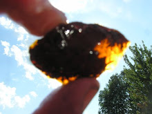
This incident shows how hard it can be to identify prehistoric stone fish weir sites unless you are diligently looking for them and are familiar with their structure. The next morning we drove back up to the site and got these photos. We then found a dense concentration of prehistoric flint shards, fire cracked rock and spearhead preforms falling out of the left bank of the river just below the weir site in a grove of silver maples. This artifact concentration helped us confirm that the weir is an actual prehistoric in-river structure.
This spot on the West Branch Sebasticook is the last shallow riffle area before the river deepens and enters a vast swampy area above its junction with the East Branch Sebasticook along Peltoma Road in Pittsfield. The West Branch Sebasticook drains a number of large natural ponds, particularly Great Moose Pond in Hartland and Big and Little Indian Ponds. These ponds were historic alewife and American eel habitat and produced large numbers of both fish (alewife migrating upstream from the ocean, adult eels migrating downstream to the ocean). This weir site was undoubtedly used to catch both species, alewives in the spring and eels in the fall. It has a classic "W" shape which allowed alewives to congregate in the center of the weir as they migrated upstream in the spring and allowed eels to congregate in the two lower points of the "W" as they moved downstream in the fall.
This weir should be included in the National Register of Historic Places because of its uniqueness and outstanding state of preservation.


5 comments:
Great to see more weir stuff - and to hook up with you. Now that the dam is gone, do the eels migrate?
Got some weir stuff here:
www.neara.org/macsween/weir.htm and at my blog:http://wakinguponturtleisland.blogspot.com/
Interesting post you got here. I'd like to read more about that theme. Thanks for posting this information.
Sexy Lady
UK escort
This artifact concentration helped us confirm that the weir is an actual prehistoric in-river structure.
How hard it can be to identify prehistoric stone fish weir sites unless you are diligently looking for them and are familiar with their structure. This can be an excellent addition to my custom paper, I guess!
kd 15
off white hoodie outlet
off white shoes
nike dunks
fear of god outlet
golden goose
hermes outlet
golden goose
supreme
supreme
Post a Comment